California-based CyArk maintains a detailed 3D digital archive of the world’s most endangered buildings and heritage sites. Managing director, Elizabeth Lee, explains the sites facing the worst effects of human aggression and climate change and plans to expose the models to a wider audience using VR.
Why was CyArk set up?
It was created in response to the catastrophic loss of cultural heritage sites, most notably the destruction of the world’s two largest standing Buddhas in Afghanistan, which were blown up by the Taliban in 2001.
Our founder, Ben Kacyra, was deeply moved by the event when he saw it in the news, and realised the huge potential of scanning technologies to accurately and rapidly document the built environment. Ben was one of the original inventors of terrestrial laser scanning – he set up CyArk with his wife.
How many projects have you completed?
Since inception in 2003 we have worked at more than 200 sites worldwide, at places including Tikal, the ruin of an ancient city in Guatemala, the leaning tower of Pisa in Italy, Mount Rushmore in the US and more modern buildings, such as the Sydney Opera House.
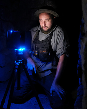
Field projects are constantly underway. Earlier this year we worked at Chavín de Huántar in Peru, a 3,000-year-old pre-Incan site in the Andes. It’s an incredible place, criss-crossed with underground passageways, a key reason for our involvement was the continual changes they have seen on the site due to increased risk of flooding as a result of glacial melt and other impacts from climate change.
What are the benefits of having accurate digital copies of structures?
Conservators can consult them to answer research questions, it’s a quick method of urgently recording monuments recently damaged or in threat of destruction.
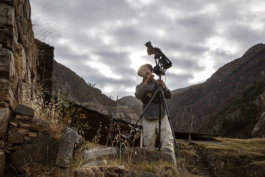
Chavín de Huántar in Peru, a 3,000-year-old pre-Incan site in the Andes
The data can be very valuable in the event of a disaster-recovery scenario. We worked last year at site called Bagan in Myanmar, south-east Asia and just a few months after we completed our recording they had a major earthquake and a number of the temples were damaged. The data in our archive has been really useful as a “point in time” record to feed into their conservation planning and management.
How has your technology evolved since you began?
There have been huge advances in technologies we use for data capture, processing and sharing. We started out capturing data primarily using Lidar or 3D laser scanning, which still forms part of our process, but the big advances are around photogrammetry and aerial image acquisition using drones.
We use a great programme called Reality Capture, by Capturing Reality, which allows us to bring together the Lidar and photogrammetric data.
The Lidar data we capture can be accurate to one datapoint every 2mm, but photographic texture resolution can be sub-1mm for even finer detail.
When it comes to processing the data, advanced software allows us to combine scanning, terrestrial and aerial photogrammetry to create highly accurate photo-realistic 3D models. We are now working to bring photo-realistic models into the VR environment, making it possible to transport people to disparate sites around the world simply using a headset and a computer.
How do you securely store the huge models you create?
We have great partnerships with other firms to help us take care of our data, for example Seagate helps with data processing, while the archive lives in an underground bunker in Pennsylvania, run with our partner Iron Mountain, so if anything happens to the online copies, or the data we keep active in our office, we have a very secure offline backup.
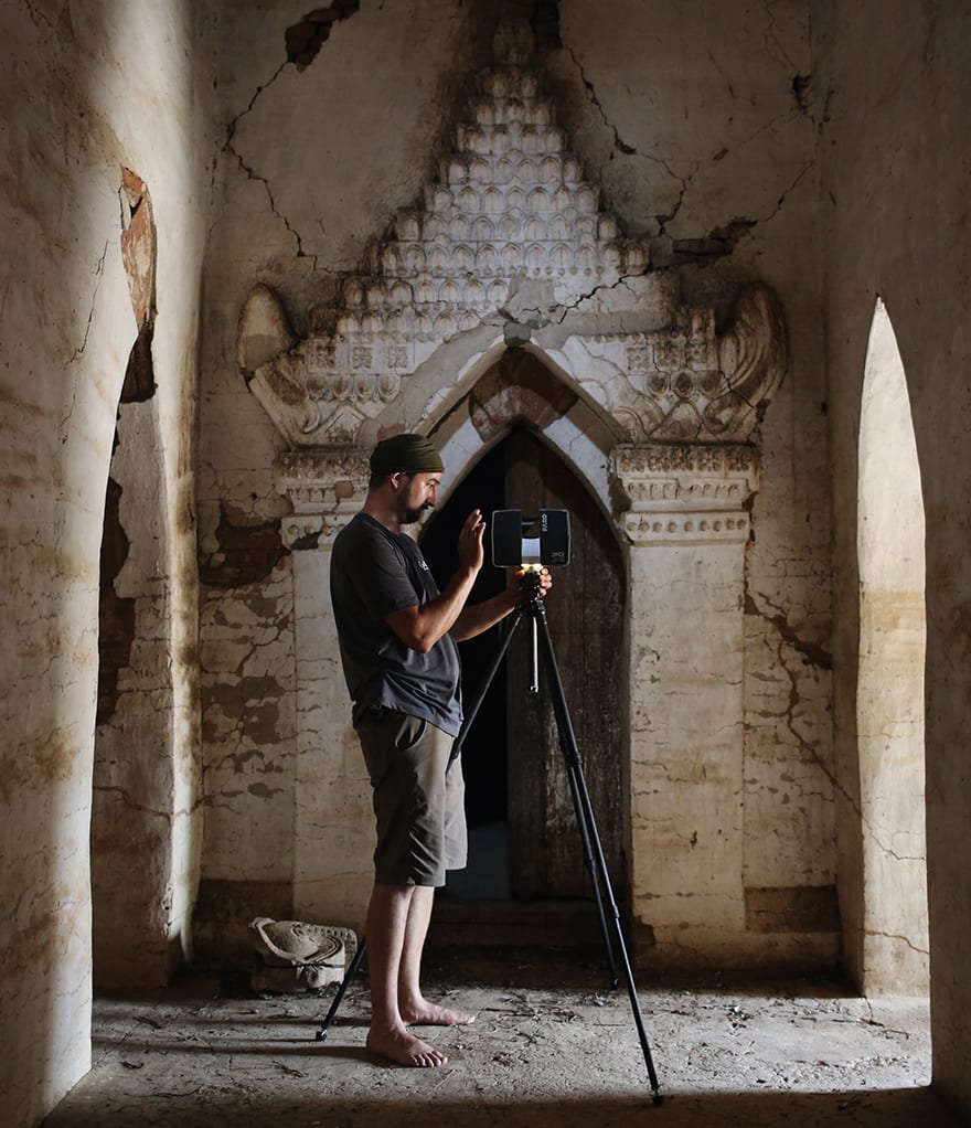
Bagan in Myanmar
Do architects, builders or city planners ever utilise the models?
Sydney Opera House brought the model into their BIM environment to help better understand the structure and manage what is a very modern and active building.
We have done a lot of work over the years with Historic Environment Scotland, which has done some remarkable things, using our recordings of the UNESCO historic centre of Edinburgh as part of city planning and other analysis.
Are there any sites you want to record but are unable to because it is too dangerous?
There are a number of site in the Middle East we would love to help on, it’s just a matter of finding a way to do it safely.
Our in-house staff complete most field projects but, in Syria, we worked with local partners on the ground and trained Syrian cultural heritage professionals in neighbouring Lebanon to do the capturing work. What has been remarkable is they continue to want to do this work because of the importance of these places.
You were unable to document the al-Nuri Mosque in Mosul before it was destroyed by Isis in June, was that disappointing?
Yes, so many significant sites in that region have been affected, including in the ancient city of Hatra, in Iraq, and parts of the ancient Assyrian cities of Upper Mesopotamia, located on the outskirts of Mosul. It has been really tragic to see.
Are wars or natural phenomena the biggest causes of destruction of heritage sites?
The human aggression stories have grabbed headlines, but we have worked on a number of projects this year facing threats due to climate change, or natural disasters. With the major hurricanes in the US and the earthquake in Mexico City in just the last few weeks, you hear about catastrophic weather events more and more and they are damaging the historic fabric of cities.
Earlier this year we worked with the National Parks Service at Mesa Verde National Park in Colorado, USA, where the hotter, dryer climate has made fire damage a real issue, completely changing the natural environment and putting a number of archaeological sites at risk.
The park is home to ancient Puebloan architecture – mud brick and mortar structures built into the cliffside around 700 years ago. When fire comes through it removes vegetation and exposes sites on the Mesa top to increased erosion and major potential collapses.
What’s next for the project?
The public release of some of our models in VR is particularly exciting. When CyArk started out we weren’t quite sure what our data might be used for in future, with VR we are starting to realise the potential to really connect people to these places and share the wonder and experience of cultural heritage – that’s a pretty powerful thing.