


Laser scanning has rapidly evolved to become an increasingly popular surveying technique in construction. Mark Combes, of Severn Partnership, details some of the benefits.
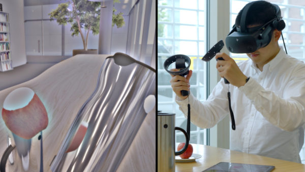
Three dimensional laser scanning or LIDAR (light detection and ranging) is the process of shining a reflectorless laser line over a surface in order to collect three dimensional data. The surface data is captured by a camera sensor mounted in the laser scanner which records accurate dense 3D points in a certain space.
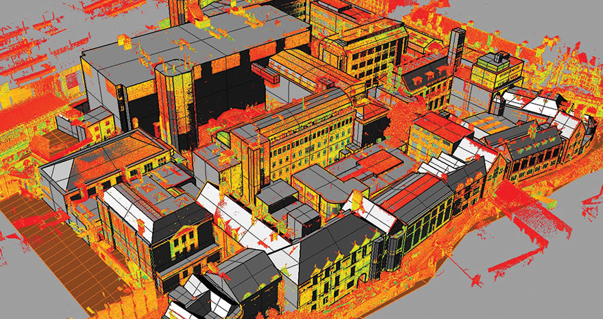
The 3D survey points collected form a “point cloud” that represents the surface surveyed. These point clouds can be used for many purposes: to create 3D CAD models for manufactured parts, or for quality inspections, but more importantly for construction managers, to create a virtual volumetric distance field, reconstructing an entire surface for the purpose of refit, renovation or construction design.
Laser scanning uses a high-speed laser and integrated camera, rapidly and dynamically analysing real environments to collect data on shape, mass, and colour in high level geometric quality. This point cloud is made up of thousands of individual reference points and is used to construct a “true” digital 3D model of infrastructure at increased accuracy. Using point cloud models of as-built structures is an ideal option for those who want to accelerate the existing conditions documentation process while increasing accuracy and reducing expenditure.
Once an area has been scanned, the data is then processed using software that takes the high definition 3D laser scanning information and converts it to a form that can be digitally manipulated to create high accuracy, fully registered point clouds. This point cloud can then be viewed in multi-hue colours or true colour. The technique provides a solution for the rapid surveying of inaccessible surfaces or complex geometric details. The data can be linked in 3D to your site grid and matched with topographical survey plans, elevations and sections.
Severn scanned Cambridge University’s New Museums Site to allow for the staged extraction of CAD elevations through the scanned site. The archive of laser scanned buildings then enabled the creation of a block outline 3D street model of the site
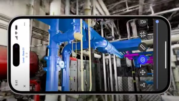
Laser scanned data can then be taken a step further by using it for building information modelling (BIM) purposes. BIM software has intelligence that enables it to understand the many elements of a surface area, or building, such as roofs, floors, windows and doors, and the inter-relationships between them. But it’s not as simple as transporting point clouds into a BIM model: it must first be translated into something that BIM can recognise.
BIM authoring tools, such as Autodesk Revit or Bentley MicroStation, can import the point cloud data using an in-built point cloud engine. The resulting 3D model includes visual material with real-life details on all external features of a site and facilitates the creation of accurate as-built 2D CAD drawings.
Using the completed 3D BIM model and 2D elevations together allows for sectional elevations and site cross sections to be created. The data also enables construction managers to deliver 2D topographical surveys of the surrounding areas and buried surfaces.
Combining laser scanning and BIM together is often viewed as a more cost effective, accurate and reliable option than traditional surveying techniques. That is because laser scanning allows for the rapid acquisition of millions of scan points representing the whole surface of an object, allowing you to survey building features at great speed and in detail. As a result, data is more accurate and easily accessible, and can also be used for a variety of other applications.
These include BIM for architectural design as well as for mechanical, electrical, and plumbing (MEP); building envelope surveys for retrofit, and refurbishment and renovation projects.
The cost of a point cloud survey is now roughly the same as a traditional 2D survey. It is more accurate and generates a 3D model from which unlimited 2D cuts can be taken. It also produces fewer errors, and lowers cost while increasing sustainability. For many construction managers, this is already an essential first step in the BIM process for any retrofit, refurbishment or renovation project.
Point clouds really come into their own when there is a design variation during construction. Before handover, a building can be surveyed to create an “as-built” model that can be compared with the original design model to provide a true digital record. This not only minimises disruption to a project but can further aid data accuracy and facilitate design work.
How does laser scanning work?
There are different types of laser scanning that cover a number of techniques:
Close range: Sub “mm” small objects or highly detailed surfaces observed from less than 0.5m away
Terrestrial: Ranges from 20m to 2km depending on the equipment, accuracy from 3mm to 100mm
Airborne: Usually taken from a helicopter covering large areas to a lesser accuracy.
In terms of applications within construction, there are a wide variety of uses for laser scanning. The technology is no longer reserved for refurbishments, as it can be used throughout the entirety of a construction project, with virtually any building able to be scanned. This includes buildings surrounded by complex service road areas, where existing and new services need to be co-ordinated ahead of construction.
A benefit of laser scanning is that it can create BIM representations that ultimately minimise disruption to complex construction projects. This is particularly useful when working on a refit or refurbishment, rather than a new build.
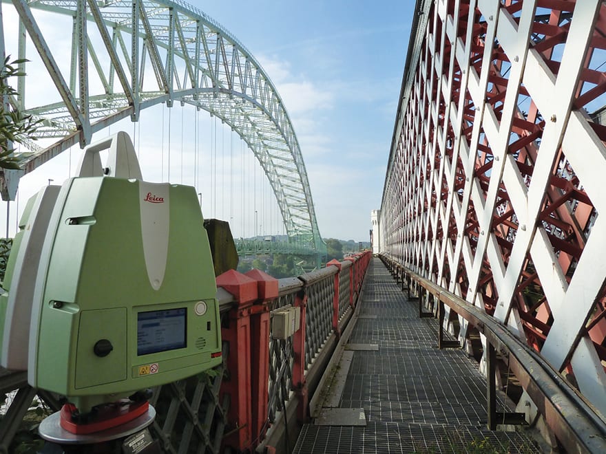
The Silver Jubilee Bridge in Runcorn (top above) was captured with a Leica 3D laser scanner (above)
For instance, we were recently commissioned to carry out 2D and 3D models for the redesign and retrofit of a complex hotel roof in London. With only four days on site and a roof constructed with many different pillars, we had to ensure that the data we collected was accurate enough to form our models. We also had to work around existing construction sites near the hotel, pedestrians and complicated details.
We began to capture the roof detail and elevations with our 3D laser scanner. Extracting 3D data from the resulting point cloud gave us the speed and quality needed in a very short time frame. The scanned data was then used to extract cross sections through the building and formed the basis of internal floor plan footprints at each floor level.
The complexity of the completed elevations highlighted how much data was gathered on the site in a short time period, minimising cost on the measured building survey. This kind of accurate data would have been more difficult to obtain through traditional surveying techniques, involving time spent on site, which would have further delayed and increased the cost of the project.
View the full potential of a site
Pre-construction laser scanning opens up the true potential of a site, enabling construction managers to visualise and test buildings in a virtual environment prior to construction. This maximises the sustainability of a project, in turn minimising waste. Previous surveying techniques explored only topography and feature locations. Laser scanning not only provides higher quality data, but provides unique visualisation options, affording construction managers and contractors a more complete picture of potential sites.
When this information is put into a live BIM representation, there are a range of possibilities for construction managers.
It is technically possible to present a life-size visualisation of the completed building project before you have even constructed any of it, which could be a major benefit to stakeholder engagement.
For instance, by combining a laser scan and BIM technology, the University of Wolverhampton was able to showcase its new science facility to prospective students, ahead of construction. Open day visitors were able to explore the entire campus, its infrastructure, and layout, without a single brick being laid.
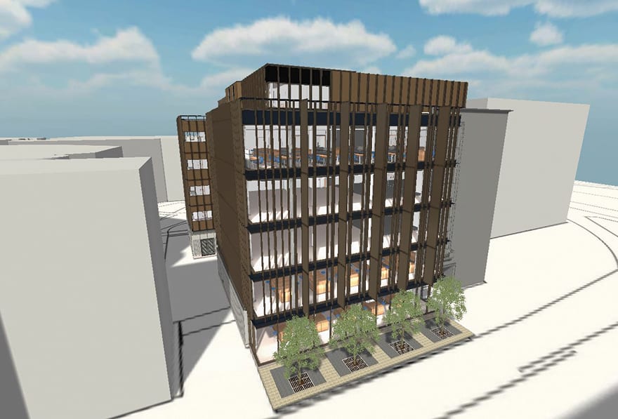
Severn Partnership used laser scanning and BIM to create this model of the University of Wolverhampton’s new science facility
During construction, laser scanning can have a number of applications, from checking the progress of a project against initial design plans and timescales to providing a valuable tool in terms of quality control, enabling construction managers to check installed elements against design models. Laser scanning also allows construction managers to verify standard compliance as a project unfolds. Use of the technology throughout the construction process also provides valuable information to project managers in preparation of future phases.
Laser scanning capabilities are not limited to extensive construction assignments either, as interior fit-out projects can also benefit. Construction managers can create a virtual 3D model of a site, which can be used to manage MEP surveying ahead of construction and provide a reference point of data for future maintenance work.
Laser scanning can also take as-built surveys to a new level. Carrying out scans at various stages of a project can provide a comprehensive as-built report of features that will ultimately be inaccessible upon completion of construction work.
As the processes behind the software used in laser scanning continues to evolve, coupled with the direct integration with design and BIM software platforms, the technology is transforming the way designers, project managers, contractors and stakeholders gather existing conditions documentation.
What is next for laser scanning?
Laser scanning comes into its own when used on projects that need scanning in difficult conditions such as failed construction sites, high voltage power stations or underground areas. A site that is completely inaccessible to humans, or holds severe risks, might present an opportunity to use these techniques.
This is where drones and other forms of “assistive technology” can be useful. Drones equipped with small scanners are already being used in some construction projects, and are capable of scanning flat surfaces and recognising open areas such as doors. Car- or track-mounted robots are used in the same way, and for projects where there is limited time on site, mobile mapping, which quickly allows scans of large areas, is growing in popularity.
The future of laser scanning is immense and with the government’s commitment that all centrally-funded projects must use BIM in 2016, laser scanning is increasingly becoming an efficient and effective way of capturing data. As data capture vehicles continue to evolve and become more customised to specific industry problems, point cloud data will remain the best medium available for capturing and studying existing conditions.
Costain drives forward with 3D scanning
Costain is using MARIO 3D laser survey technology to map train lines as part of its work on the UK’s plan for train electrification, writes Dave Arminas for BIM+. In February, Costain and JV partners Alstom and Babcock won a £900m, seven-year framework under Network Rail’s National Electrification Programme.
MARIO – which stands for Mass Asset Recognition and Intelligent Optimisation – uses a laser scanner to capture physical structures and produce accurate 3D digital models for use by maintenance workers, installation contractors, facilities managers and design engineers.
To map roads and motorways, a scanner is mounted on top of a van and driven along the carriageways at normal speed taking “pictures” of everything it scans, explains Joe Rice-Jones, asset programme manager for Costain.
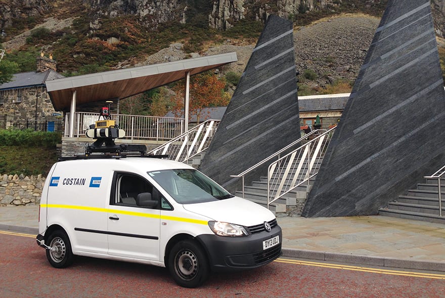
But for MARIO’s diversification into the rail sector, Costain has been hiring a maintenance train engine, mounting Topcon’s Compact Plus imaging scanner on the front and running it along main rail lines. The contractor reports immediate savings in time and money because MARIO means there is no longer a need to invest hundreds of man-hours in physical inspections.
The laser scanner logs around 30,000 points per second and arranges them in a coordinate system where the points are defined by X, Y, and Z coordinates to create a 3D image called a point cloud. Point clouds, which appear as masses of dots, are then used to create detailed life-like 3D CAD models for objects such as manufactured parts and buildings.
The 3D images are also automatically geo-referenced by way of a geographic information system (GIS). This means that a scanner’s point cloud can be used to create a highly detailed moving image enabling an asset manager to virtually tour a site such as a roadway.
The system’s accuracy for pinpointing the exact geographic location of an object is around 40mm if the scanner is mounted on a moving platform, such as a car.
But accuracy improves greatly if the scanner is stationary, says Rice-Jones. If set up on a tripod, scanner accuracy is around 1mm.
The technology can also be used to as the basis of data-rich BIM models. Construction companies can use BIM authoring tools, such as Bentley’s MicroStation or Autodesk’s Revit, to bring point cloud data into a 3D environment and then create their own images of roads, rail lines or other infrastucture.
If a supermarket chain has 1,000 stores in the UK, Rice-Jones suggests that three buildings or sites could be surveyed a day, giving a complete graphical inventory of the estate within a year.
“The images can be demonstrable evidence when presenting a case for maintenance, or when an FM is going in search of money within his or her organisation for the work,” he says.
In 2013 MARIO, which then incorporated the Trimble MX8 laser scanner, was also used to facilitate the refit of the tunnel infrastructure at Heathrow Airport. Using a traditional approach would have meant closing the tunnel, logistics planning, traffic management, physical measuring and night work. However, using MARIO mitigated closure and the project avoided these complications.
MARIO was the first winner of the Costain Start-Up initiative, an internal competition launched in 2012.

This article is also posted on Construction Manager’s CPD portal, see below for details on how to register

Comments
Comments are closed.


Highly informative article, showing the modern practice used in our everyday working survey engineering field!! : )
Good review of the current state of the art.
Costain and Track Access Services have now added HD video to their train-borne laser survey…very impressive!