


Autodesk has announced a series of updates that include a carbon analysis tool and deeper integration with Esri’s GIS platform.
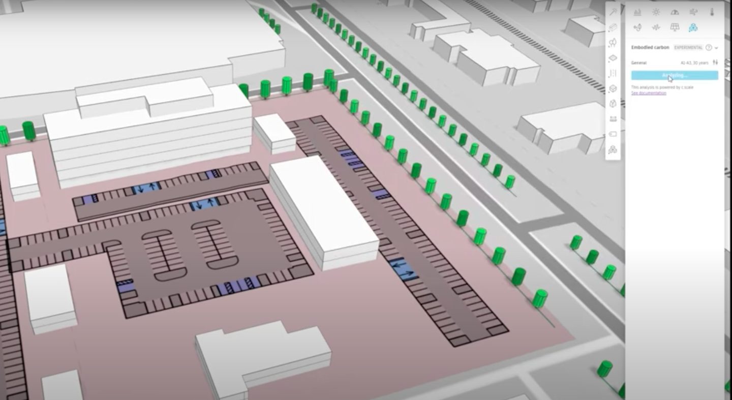
Total Carbon Analysis for Architects offers new capabilities that track the carbon footprint of a building from planning through detailed design, according to Dan Lohmeyer, vice president, product development at Autodesk.
In an Autodesk blog post, he revealed: “This includes embodied carbon analysis in Autodesk Forma, which is supported by AI capabilities and enables architects to understand and test the carbon impact of their design decisions at the beginning of project planning. Also coming soon are new capabilities developed in Autodesk Insight, which measure carbon impacts from lighting, HVAC, architectural elements, building materials, and more.”
Lohmeyer also offered some detail on the deeper integration with Esri’s ArcGIS platform: “We’re expanding our strategic alliance with Esri to release new integrations of ArcGIS Basemaps with Civil 3D and AutoCAD to provide civil engineers with detailed geospatial data and mapping capabilities.
“Enhanced visibility of existing conditions empowers users to optimise designs that minimise environmental impacts and ecological disruption. In addition to design workflows, a new update to our integration with Esri’s ArcGIS Online and Info360 Asset gives water and wastewater network operations and maintenance teams improved access to asset condition data, risk analysis, and rehabilitation plans.”
Lohmeyer also revealed that Autodesk’s digital twin tool, Autodesk Tandem, will soon be available for BIM Collaborate Pro subscribers.
Don’t miss out on BIM and digital construction news: sign up to receive the BIMplus newsletter.


