


A round-up of BIM and digital construction stories that you might have missed in the past seven days.
Mapping the biodiversity alongside the road network
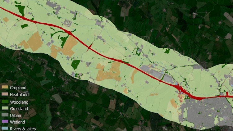
A detailed map of the habitats found alongside England’s busiest roads will be produced for the first time under plans to boost biodiversity. Manchester Metropolitan University has been commissioned to develop a new mapping system that will make it easier for National Highways to keep track of the ecosystems bordering the country’s 4,300 miles of motorways and major A-roads.
The research and development programme will use more than 20 different sets of data to overlap and layer National Highways’ soft estate, roughly 28,258 ha of green land close to the roads.
Buildots raises $60m to expand
Buildots has raised $60m to expand the use of its hard-hat mounted, AI-led site progress monitoring technology to support commercial and planning teams. Buildots technology will integrate with planning platforms Oracle Primavera P6, Asta Powerproject and Microsoft Project to allow instant timeline updates, while for commercial roles, it will provide monthly progress reports that validate subcontractor payment applications.
What’s the future of the industrialisation?
The brief, dazzling life of Katerra – the American start-up that claimed to have revolutionised construction with its tech-driven approach to mass prefabrication, only to collapse completely in June last year – has not soured the digital construction dream in the US, according to Global Construction Review.
Dates for your diary
Don’t miss out on BIM and digital construction news: sign up to receive the BIMplus newsletter.


