


Aerial mapping company Bluesky International wants to help identify poorly insulated homes and other public buildings using high-tech thermal imaging to measure heat loss from roofs.
The company’s property level heat loss maps provide an accurate and up-to-date picture that could be used to pinpoint homes eligible for financial support, such as the UK government’s Green Homes Grants.
The chancellor recently announced a £2bn package of grants for energy-efficient home improvements, including installing insulation, double glazing and replacing old boilers. Half of the package will be spent making public buildings, including schools and hospitals, more environmentally friendly, with £50m going towards retrofitting social housing with insulation, double glazing and heat pumps.
“The government announcement of support for homeowners to improve the energy efficiency of their homes as part of a wider green jobs package brings thermal surveys to the forefront,” said Rachel Tidmarsh, managing director of Bluesky International. “The intelligence we can derive from a thermal image can help target this money, highlighting at a glance properties that would benefit from additional insulation and double glazing.”
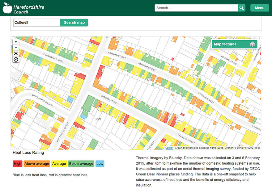
Colour-coded thermal maps have been provided to local authorities across the UK
Bluesky has been producing thermal maps for towns and cities across the UK covering a significant percentage of the population. Working with property owners, local authorities and energy companies, the colour-coded thermal maps, combined with other types of geographic data such as local authority address database, are used to give accurate and up-to-date information to tackle fuel poverty, manage carbon emissions and improve energy efficiency. The heat loss data maps have also been used to identify illegal dwellings – known as beds in sheds, and even uncover cannabis factories.
Thermal surveys are flown in the winter months, during the evening and after sunset, to capture the widest variations in temperature that can occur as a result of poor insulation or excessive energy consumption. The data can be produced ready for use in a Geographical Information System (GIS) or Bluesky can produce a list of properties with high heat loss values.
Using a ‘microbolometer’ thermal camera specifically designed for airborne surveying and ideal for use in aircraft flying at night allows for measurements of heat loss from property roofs to be recorded with higher precision and more consistent results than other systems currently in use in the UK.
Comments
Comments are closed.


Aerial mapping is not new it just that it has not been put to use very often.
Congratulations to Bluesky for getting the ball rolling, much needed.