


The London Borough of Harrow has added high-definition, street-level imagery and LiDAR data to its Esri UK GIS system, giving staff access to an accurate digital twin of the borough.
The move is part of Harrow’s strategy to explore new digital approaches and advance its digital twin agenda.
Harrow previously relied on other sources of street level imagery but wanted more accurate, higher resolution and timely information to provide a true virtual understanding of its local area. Esri UK brought in partner Cyclomedia to help solve the challenge. Cyclomedia data is captured by its fleet of 100 megapixel camera cars and includes roads in Harrow that were not covered by the previous street imagery.
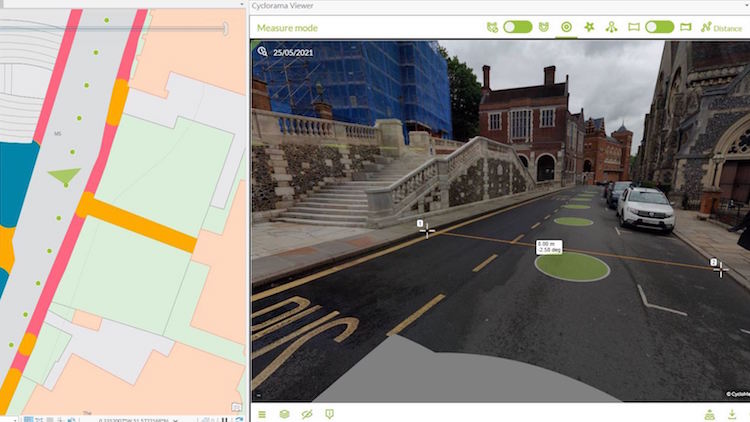
The new imagery and associated LiDAR data provides a full 3D digital representation of the environment and can be viewed simultaneously alongside other geospatial data within the Esri GIS, such as street furniture, council tax records, planning applications and Ordnance Survey data.
The new imagery will mean the planning department can view properties alongside planning applications, the highways department can verify that street works have been delivered or plan new mobility schemes, such as cycle lanes, while the council tax department can carry out remote property inspections.
Users can also apply the various analysis tools within the Esri GIS system to the imagery, such as accurate measuring of properties or boundaries and view analysis, to determine where shadows may fall from future developments, for example.
“The Cyclomedia data helps us to achieve a digital twin, easily accessible within our Esri GIS to make remote decision-making easier for staff, right across the organisation in numerous departments,” explained Sam Tizzard, head of GIS at London Borough of Harrow.
“High resolution, current and time-stamped imagery along with LiDAR data gives us a reliable digital twin of the borough that we can trust, which is vital in carrying out effective management, maintenance and planning. It also helps to dramatically reduce site visits, which is essential as new hybrid working methods evolve to help keep staff and the public safe due to covid-19.”
Harrow has been a customer of Esri for more than 15 years. “This is the first UK example of Cyclomedia and Esri GIS integration, so we’re looking forward to helping Harrow explore the possibilities of what this innovative project can deliver in coming months,” said Paul Clarke, head of government at Esri UK.
“Local councils are being asked to make important decisions about their dynamic urban environments, together with increased remote working: an accurate digital model enables decisions to be made objectively,” added Fergus Craig, UK sales manager at Cyclomedia.
Other city authorities using Cyclomedia’s imagery and LiDAR data include New York, Amsterdam, Paris and Frankfurt.


