


An advanced BIM model of the entire city of Helsinki, Finland, is being used by authorities to calculate the solar potential of around 80,000 buildings as part of a bid to meet ambitious energy targets.
The €1m Helsinki 3D+ project was launched to produce two 3D models of the city using innovative new data capture technologies: one a high-quality reality mesh model; and one in CityGML, incorporating geometric components and attached information.
A spin-off initiative, known as the Helsinki Energy Atlas project, is harnessing the CityGML model to calculate the solar energy generating potential of every surface of every building in the city (more than 900,000 surfaces in total) including every roof and external wall.
Jarmo Suomisto, project manager for Helsinki 3D+, told BIM+: “Energy conservation has become very important in cold countries of the north. Helsinki is committed to become a carbon neutral city by 2050 and greatly reduce its dependence on fossil fuels, the new mayor recently announced an even more ambitious plan to achieve this by 2035.
“Our CityGML model is an important tool and test bed to help assess potential energy savings.”
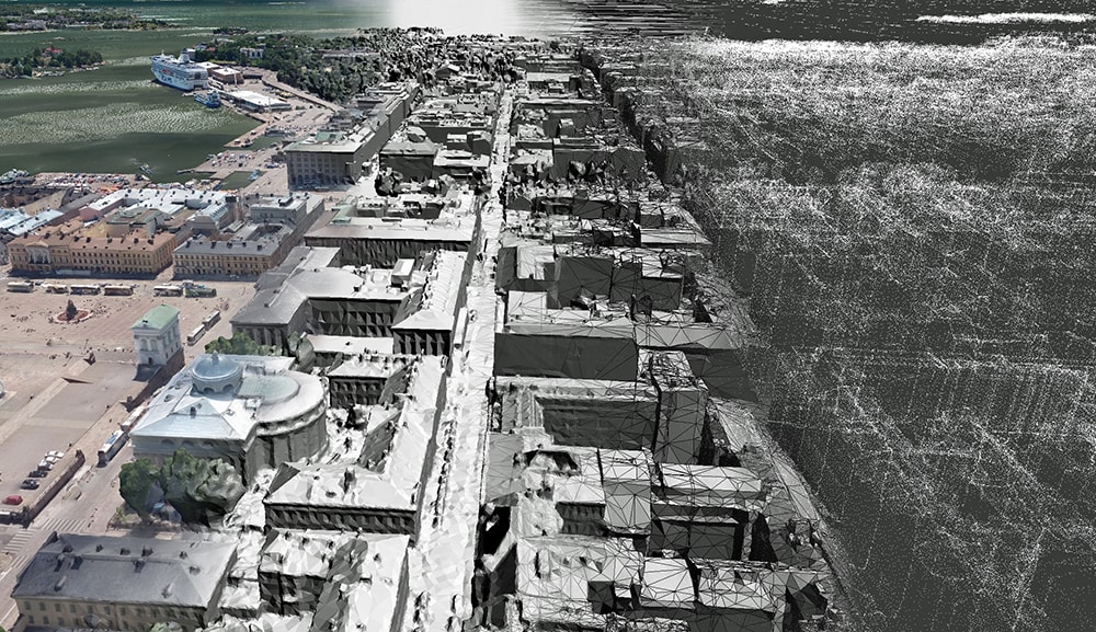
The high-quality reality mesh model
The information will form the basis for a new website, where homeowners can assess the solar potential of their homes and access a range of products from photovoltaic suppliers.
The solar energy analysis was carried out at the Munich University of Applied Sciences and Helsinki is understood to be the first city where the technology has been applied.
Helsinki has a total of 12 pilot projects utilising the 3D city models. A key application is use of the CityGML model to define the timetable for various changes under the city masterplan to share with decision makers and citizens online.
An interaction platform for city planning is being developed to enable citizens to turn dials and press buttons to indicate that they want more, or less parking, or more parks etc. City planning employees will then incorporate the data into their design processes.
Further applications are envisioned for the future, says Suomisto: “The big thing in future is to integrate the model into every service process in the city, which can help in so many ways. This could include connections for buildings, to drainage and the electricity grid to help anticipate how a new development will impact on infrastructure.
“But it’s a more long-term project requiring many more processes and there remain many barriers to making it happen.”


