


3D modeller Vertex and digital communications agency Wagstaffs have launched an interactive 3D digital model of London called Vucity.
The model, “rendered in massing block detail”, covers 80 square kilometres of central London, from Earls Court in the west to the ExCeL exhibition centre in the east, up to Old Street and down to Battersea.
Using the model, users will be able to rotate around London and zoom in to the detail of an individual building.
According to the creators, this will allow property developers to communicate their projects to the public and could “transform” the planning of proposed and new developments.
The Vucity model will also feature on the London Chamber of Commerce’s stand at MIPIM 2015.
Jason Hawthorne, managing director at Wagstaffs, says: “This sort of modelling is the future of planning. It is not that long since planning applications only required site maps and elevations. Now no planning department will accept an application without CGIs. It cannot be long before they all require interactive 3D models such as Vucity.”
But the tool is essentially a standalone system, using its own viewing software, rather than standard BIM software tools. According to its creators, it “sits outside of the BIM environment – it takes input from BIM but you cannot export back into BIM”.
It operates across all digital platforms such as touchscreen, video wall, tablet or desktop.
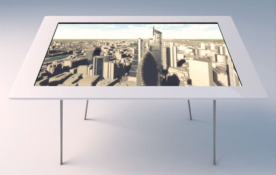
Vucity installed on a touch table
Wagstaffs has already produced viewing tools such as Vumapp and Vuitnow, which has been trialled by the Crossrail BIM team as a user-friendly interface for accessing BIM data in the field.
Wagstaff’s Hawthorne, explaining why the comprehensive model was created, says: “Our agency is always working on some aspect of a development in London, whether it is at the consultation, planning or marketing stage. An early stage of every project is to model the context for the development. We were doing it so often that we reached the point where it just made sense for us to model the whole of London.”
He continues: “We are in the early stages of discussing specific applications with potential partners, but the possibilities are extremely exciting. Never before have property professionals been able to use such a detailed and extensive view of London. With a click of a button they can overlay their proposed developments and see them in context.”
The model could have many planning applications, allowing for more informed decisions to be made on developments in the city.
It could also be adapted to develop a strategy for the development and planning of the entire city. Last year the Architects’ Journal included the creation of a “fully interactive 3D computer model of London’s emerging skyline”, as one of its five recommendations to the major as part of its campaign to protect London’s Skyline.
This sort of modelling is the future of planning. It is not that long since planning applications only required site maps and elevations. Now no planning department will accept an application without CGIs. It cannot be long before they all require interactive 3D models such as Vucity.– Jason Hawthorne, managing director, Wagstaffs
Comments
Comments are closed.


This is becoming more affordable, more available and more popular by the day. 3D photogrammetry software now enables drones to take photos that are then turned into geospatialy accurate BIM models. There are good examples here, including a 3D model of Paris – created from photos rather than point clouds.
http://www.acute3d.com/s3c-samples/