


Leeds City Council has used a precursor to satellite imagery to identify the heat loss from homes in the city.
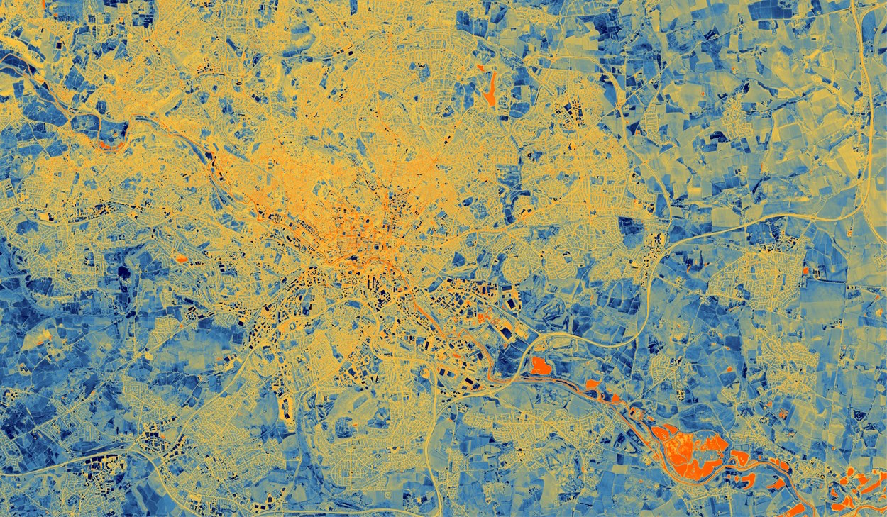
Earlier this spring, a specially equipped plane mounted with a thermal imaging camera flew over Leeds. The flight captured data that reveals insights into how much heat is being lost from the buildings below.
The aerial thermal imaging technique, developed by Satellite Vu, can help identify the ‘leakiest’ buildings in a large area. It promises to collect and analyse heat loss data at an unprecedented level of detail and scale, according to the council. Eventually, the technique will use cameras on orbiting satellites.
It was part of a pilot to demonstrate a new technology that could be used to reduce the environmental impact of housing in Leeds and elsewhere by making homes more efficient.
According to Leeds Climate Commission, about 25% of the city’s carbon footprint comes from the energy used to heat and power homes. Poorly insulated roofs, walls and windows are common ways that properties lose heat.
Net-zero charity MCS Charitable Foundation funded the test.
Leeds’ net-zero plan
The council will use the data collected to inform the work it is undertaking as part of its Net Zero Homes plan. The document sets out actions the council will take to install low-carbon heating and tackle heat loss from homes.
The council intends to use insights from the test to help residents better understand the thermal efficiency of their properties. The council will also use the data to motivate retrofitting in the private sector.
Councillor Helen Hayden, executive member for infrastructure and climate, said: “This is an innovative project that could transform our understanding of building heat loss at the city level. It potentially unlocks additional investment in energy efficiency measures that cut energy bills and help us tackle climate change.
“Leeds already has a strong track record of delivering energy-saving improvements to thousands of homes. But we know that plenty more needs to be done. By giving us street-by-street insight about heat loss, this new technology could help us do just that.”
Dr Richard Hauxwell-Baldwin, research and campaigns manager at MCS Charitable Foundation, said: “There are 29 million homes in the UK that urgently need upgrades to be fit for the future. We need detailed data on building conditions on a massive scale. This proof of concept could provide that data for the first time. It will be game-changing for investment in whole-street and whole-area retrofitting programmes.”
Don’t miss out on BIM and digital construction news: sign up to receive the BIMplus newsletter.


