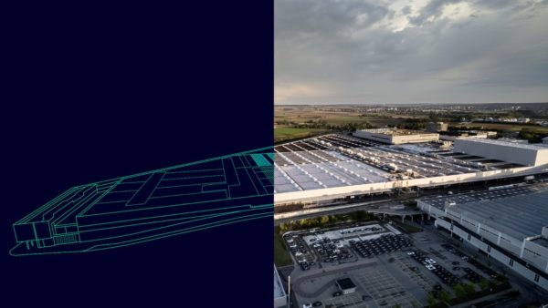
Earthworks is going digital – now it’s about the data not just the dirt. The road to full autonomy might be a few years away, but already machinery on construction projects is delivering efficiency gains from use of drones, data and other digital technology. Nick Drew reports.
Earthworks has always felt detached from the rest of the construction industry, as the machines and their operators are chiefly engaged at the front end of projects.
But just like the rest of the built environment sector, earthworks has been quietly undergoing its own digital revolution, which is now becoming far more integrated into the wider construction industry, as technology starts to support greater levels of understanding and decision-making.
Recent advances in digital technology used with construction machinery are offering significant productivity improvements. Equipment manufacturers such as Komatsu and Caterpillar are leading the way in machine control technology – where 3D terrain models and global positioning system (GPS) tracking are used to position and guide earthmoving equipment – and say that at least a 30% increase in productivity is possible, sometimes much more.
Major contractors are also beginning to recognise this potential. Victor Snook, head of digital at Balfour Beatty Construction Services, says the move away from paper and adoption of digital technology by construction managers is opening up potential productivity improvements in the earthworks sector.
“Through the use of onsite connected technologies, using cloud-based solutions like 360 Field, we are working with our supply chain partners to digitise processes and streamline data management,” he says.
“For example, where we use site location codes now to enter digital information, in the future we will be able to use GPS location data to fill in material delivery tickets, inspection tests, adjust plans, access models and much more.
“Drone data and photography, synced to the cloud, will provide automated reports on earthworks progress.”
Balfour Beatty has already successfully employed digital technology on the earthworks phase of the 20.1km Norwich bypass scheme (see below). Snook says use of data to drive similar projects in future will become more commonplace.
“With all data from connected earthmoving machines, devices and drones saved and sharable from the cloud, construction managers on earthworks projects will have a much greater understanding of what work has been done, whether they are on programme and what next steps to take,” he says.
“We know this is all going to be possible, as we are already working on selected projects where we have created data-rich models. These models are accessible from iPads and use software that can work out the required cut and fill volumes, linking to surveying data, including 3D models from photo telemetry imagery and point cloud surveys.
“With drone data reducing the cost and improving the quality and speed of surveying, we will be able to look at yesterday’s work to plan for today, tomorrow and beyond.”
At another main contractor, BAM Construct’s digital manager Mark Taylor says the new technology can help de-risk earthworks projects for construction managers.
“The digital earthworks journey is only just beginning. Construction managers of the future could well have navigator as their title. This is because the massive datasets that will be available in the future, will give them real-time decision-making capabilities, to manage sites and programmes
much more effectively.
“The real-time aspect of digital construction is going to be very beneficial, but equally important is the overall collection and use of information, to improve future project outcomes.”
Data collection, management and analysis will be at the heart of how digital technology will be employed in the earthworks sector, says Taylor.
“If we record everything we do, we can also compare, contrast and benchmark different approaches, sharing this information with our supply chain, so everyone can learn from it,” he says. “This will then help us make the best, most efficient decisions when it comes to earthmoving.”
He adds: “Having a clear under-standing of the digital workflows on a project helps us to work more efficiently with suppliers, so we can all understand each other’s information needs properly and ultimately deliver projects more efficiently.”
At the equipment manufacturer level, Caterpillar says take-up of machine control and digital technology among earthworks hirers and contractors is steadily rising.
Mick Knight, head of infrastructure and construction projects for Caterpillar dealer Finning UK & Ireland, says: “With the cost of technology reducing and more factory-fitted solutions available, we are now seeing the opportunity for increased scalability, with real-time solutions previously only used in mining now being applied to earthworks projects.”
Knight says the key to the successful use of data on earthworks is to compile the information from each machine into one central database, so that construction managers can access live dashboards, or automated reports.
“This can include how earthworks are progressing, by overlaying data on the surface model, the health of assets on site for maintenance planning, right down to the individual payload performance of a single machine,” he explains.
“The benefits of having this information at their fingertips is the greater connection construction managers can have to the operator community on site, as the data will measure productivity, accuracy, maintenance costs and therefore the true cost per tonne of material moved.”
A welcome knock-on benefit should be cost savings from fuel economy and reduced maintenance, Knight says.
“Stakeholders will be able to address a whole range of cost and carbon issues, associated with activities like high levels of machine idling or waiting time and poor site haul road maintenance. These issues not only contribute to increased fuel burn, they are also responsible for increasing maintenance costs and overall machine availability.”
The next step on the digital journey for the earthworks sector is likely to be artificial intelligence.
Balfour Beatty’s Snook envisages onboard software using data about the site to make intelligent decisions about how the machine executes earthmoving operations.
“With mobile equipment capable of using GPS and camera technologies, you could easily see machines collecting more useful site-based data,” he says. “With images from numerous devices taken across a construction site, the software can examine all these thousands of pictures, and identify trends or issues in real time. What this could mean for earthworks projects is that the first level of risk analysis and reduction would be driven by the data.”
Ultimately perhaps, it raises the slightly unnerving prospect of giant earthmoving machines which are capable of learning on the job.

Komatsu’s intelligent excavator brings Japan’s ‘smart construction’ to the UK
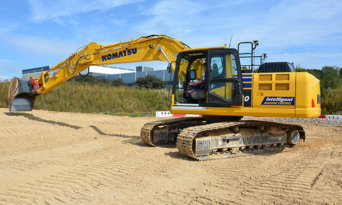
Japanese manufacturer Komatsu has been at the forefront of digital technology in the earthmoving sector, driven partly by the national government’s vision of “smart construction” – where automation plays an increasing role in the building industry to combat a predicted worker shortage.
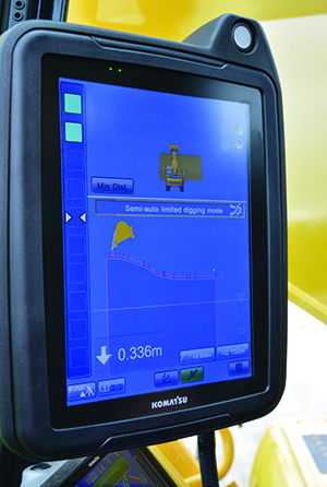
Komatsu’s integrated machine control solution is also available in the UK. The company’s PC210LCi excavator comes with automatic real-time digging control, and uses GPS receivers which combine with onboard software to show earthworks progress on the in-cab display (pictured).
Somerset-based groundworks contractor Gartell & Son has been using the Komatsu PC210LCi since 2016, across all aspects of its groundworks contracts, from bulk excavation to drainage and trimming.
Director Andrew Gartell says: “There is no daily rigmarole of setting up lasers and depth receivers on the excavator and relying on our engineer to visit each site to set out prior to works being able to commence. With the LCi system we can get to site, carry out machine pre-checks on arrival, set up the base station and start work quickly.
“Another advantage of the intelligent machine control system is safety. No operatives or groundworkers are walking or working in close proximity to the excavator, as the surveying and setting out can be carried out from the safety of the office and cab.”

Drone capabilities take flight
The use of drone photography for surface modelling of site topography is becoming a key part of project planning and monitoring in the earthworks sector.
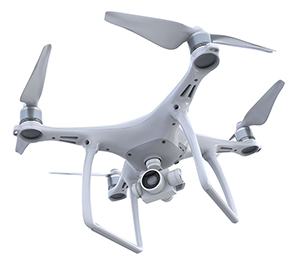
As drone capabilities become more advanced, their benefits will only increase, says Mark Christian of global drone specialist Airware: “The coming together of datasets onto a single ‘canvas’ is the next level. It will have a transformational impact on programme timings and logistics.
“In the case of earthworks, drone data will link with GPS-connected devices and RFID tagged materials. If the project manager wants to know where the right-sized aggregate is and how much is in stock, the closest fleet to move the aggregate, and where the nearest machine is to grade it, this data canvas will provide that information.”
And it can help the supply chain, he adds: “For example, the canvas could be shared with the structural steel team so they can see the earthworks progress and site layout to help plan their production and site delivery.”

Highways England pilots machine control
The speed of adoption of technologies like 3D machine control has accelerated thanks to projects like the 19.3km Leeming to Barton motorway extension – delivered by the A1M2 Consortium – which was the first fully 3D machine-controlled and surveyed site, funded by Highways England.
At its height, earthworks specialist Potter Plant Hire, led by Giles Potter, had 40 machine control units in operation, from various equipment manufacturers, all supported by Trimble’s 3D machine control system, supplied by Sitech. All of the information generated by the Trimble system was used by surveyors on site and linked into a BIM model.
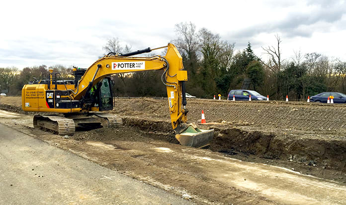
Potter explains: “We used two Trimble ‘base stations’, to cover the whole of the project site and each
day we were able to assess our progress using the model.
“This gave us forward insight to plan the arrival of equipment onto site, schedule works around harsh weather conditions and react immediately to 3D model changes. This was particularly important when it came to the accuracy of the sub-base layers of the new road – which had to be to the millimetre – as compaction levels varied across the site, requiring more material in certain areas.
“Right from the start of the project, the digital construction approach really set a benchmark. Modelling earthworks in BIM before work began helped the earthworks team identify where to excavate and place material across the site.”

Norwich bypass uses onboard data in real time
As one of the largest road projects currently under construction, the Norwich bypass is the first of its kind to use onboard Cat advanced production measurement data, to support the earthworks management of the project.
Main contractor for the project, a 20.1km dual carriageway which runs from Attlebridge to Postwick, is Balfour Beatty. The earthworks is being delivered by P Flannery Plant Hire, under the eye of operations manager Niall Hester.
“For this project we have a completely new and matched connected fleet with payload monitoring technology,” he says. “This includes more productive ejector trucks and hybrid excavators, both in-cab monitors ensuring they are achieving best fill rates, which optimises fuel burn per tonne on each cycle.
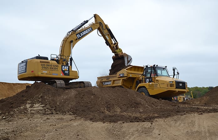
“No matter where the units are working on the project, data can be sent and received in real time. For our team on site, this data is sent via VisionLink into the Caterpillar online portal. This means that our managers and the Balfour Beatty team can login from any connected location.
“Being able to measure and calculate data, including the tonnes per load, tonnes per cycle, distance travelled per day, and how many litres of fuel a machine burns per hour, each day – we can have a clear picture of where we are in the programme.
“This has allowed us to manage the project more effectively as we know, through GPS, where the machines have been working and the amount of earth that has been moved. So each day both teams are learning more about the performance of the equipment and therefore how to optimise the management of the site.”