Site scanning specialist Navvis has pitted its VLX wearable mapping system against a more conventional terrestrial laser scanner with startling results.
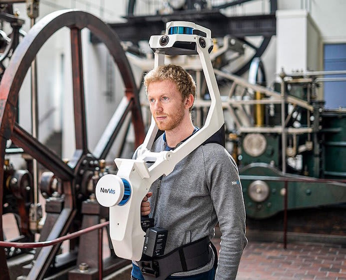
The VLX is equipped with two LiDAR sensors and four cameras, allowing it to "quickly and efficiently capture survey-grade point clouds… and capture high-resolution panoramic images in a complete 360 degree field of view", Navvis said.
The VLX positions the hardware on the front and top of the operator. This provides several advantages over backpacl models, Navvis said: "Wearing the device on the front enables the operator to have more control over where the sensors are scanning, which improves data quality. The operator is also able to view and interact with the built-in screen that provides live feedback of what has been scanned and the quality of the data being captured."
The test involved the scanning of an office environment and the terrestrial laser scanner registered a capture time of two hours and one minute, generating 2.2GB of raw data, 21 panoramic images and nearly 45 million points; by comparison, the VLX scanned the space in 25 minutes, generating 9.8GB of raw data, 152 panoramic images and more than 74 million points.
Watch the film: https://www.navvis.com/resources/videos/navvis-vlx-vs-tls