


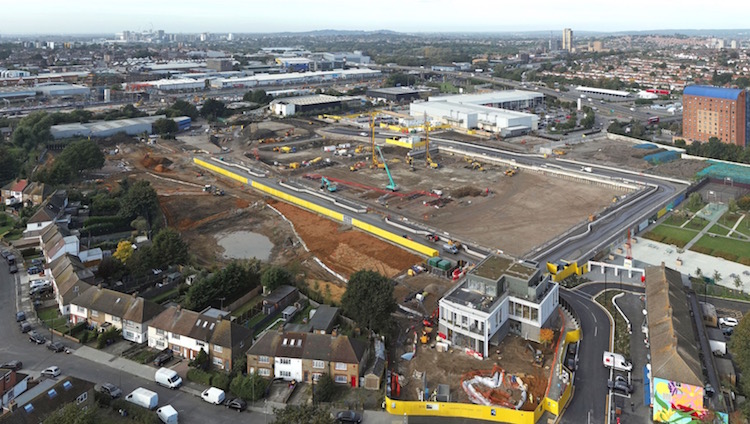
Brent Cross Town, a joint venture between Argent Related and Barnet Council, is using Site Scan drone flight management and image processing software from Esri UK to improve the efficiency of groundworks surveys and how it communicates progress of the £7bn north London development.
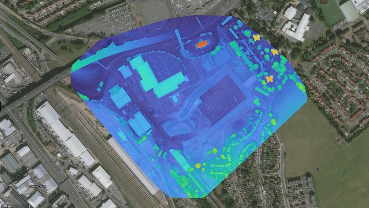
The software is being used to create 3D point clouds, textured meshes, video and 360-degree panoramas, enabling accurate and consistent updates to be shared among all stakeholders.
Previously known as Brent Cross South, the new development incorporates 20 ha of parks and playing fields, which are central to the attraction for people to live, work and visit. Brent Cross Town will deliver 6,700 new homes for sale and for rent and will be a major new office destination.
The developers wanted to create a consistent and efficient method of monitoring site progress and make the overall drone programme easier to manage.
Lily Wydra, GIS, land and property manager at Argent, explained: “Before Site Scan, we had no pre-existing software specifically for planning flights or managing and processing drone imagery outputs. Now we have a consistent framework for managing all flights through our supply chain, processing images, creating high-quality geospatially-enabled outputs and disseminating them to multiple stakeholders. As a cloud-based service, Site Scan also means we can work seamlessly with contractors, such as civil engineering contractor Galldris Services, who we’ve currently requested to carry out drone survey work.”
The drone team at Galldris has been regularly flying drone surveys with its fleet of drones and using Esri Site Scan under Argent’s operator licence since March 2021.
The team now processes monthly drone outputs to support internal operations and delivers them to Argent, which uses and disseminates them through a collection of ArcGIS Online maps and apps.
Outputs include 3D point clouds that have been helping construction managers, technical teams and contractors understand how changes in site topography will impact the site and for performing volumetric calculations, on how much earth needs to be excavated and removed.
Video, static images and 360-degree panoramas have been used to provide project teams, investors and the public with visual updates on construction progress and by legal teams when working on leases with potential tenants.
“Site Scan has enabled us to create a formalised and repeatable approach for generating digital drone outputs, irrespective of the survey provider, which is also proving to be more cost-effective than commissioning one-off surveys,” commented Wydra. “Drone usage is increasing so having a scalable framework to manage flights and streamline the integration of data captured into GIS, BIM and CAD workflows is proving invaluable. Ultimately, better drone outputs support a better data-driven decision-making process.”
Site Scan connects with Argent’s enterprise GIS, Esri ArcGIS, and is enriching geospatial datasets. Drone data can be quickly published into ArcGIS Online to enhance pre-existing online maps, including those on site or shared with Barnet Council, which has started to publish some data layers in its Masterplan.
Brent Cross Town is the first Argent Related project where Site Scan has been deployed but the developer is planning to use it at other major developments, including King’s Cross and Tottenham Hale, as the demand for drone data increases.
Wydra concluded: “Engineering is a precise school of activity and drones are a relatively new part of the workflow but now they are working alongside tried and tested engineering practices and surveying activities. Site Scan is helping to build a more coordinated and efficient way of managing our drone programmes and will soon move to other developments as we scale it across the business.”


