West Yorkshire-based Airedale General Hospital is saving time monitoring its issues with reinforced autoclaved aerated concrete (RAAC) thanks to a digital twin developed by BIS Consult.
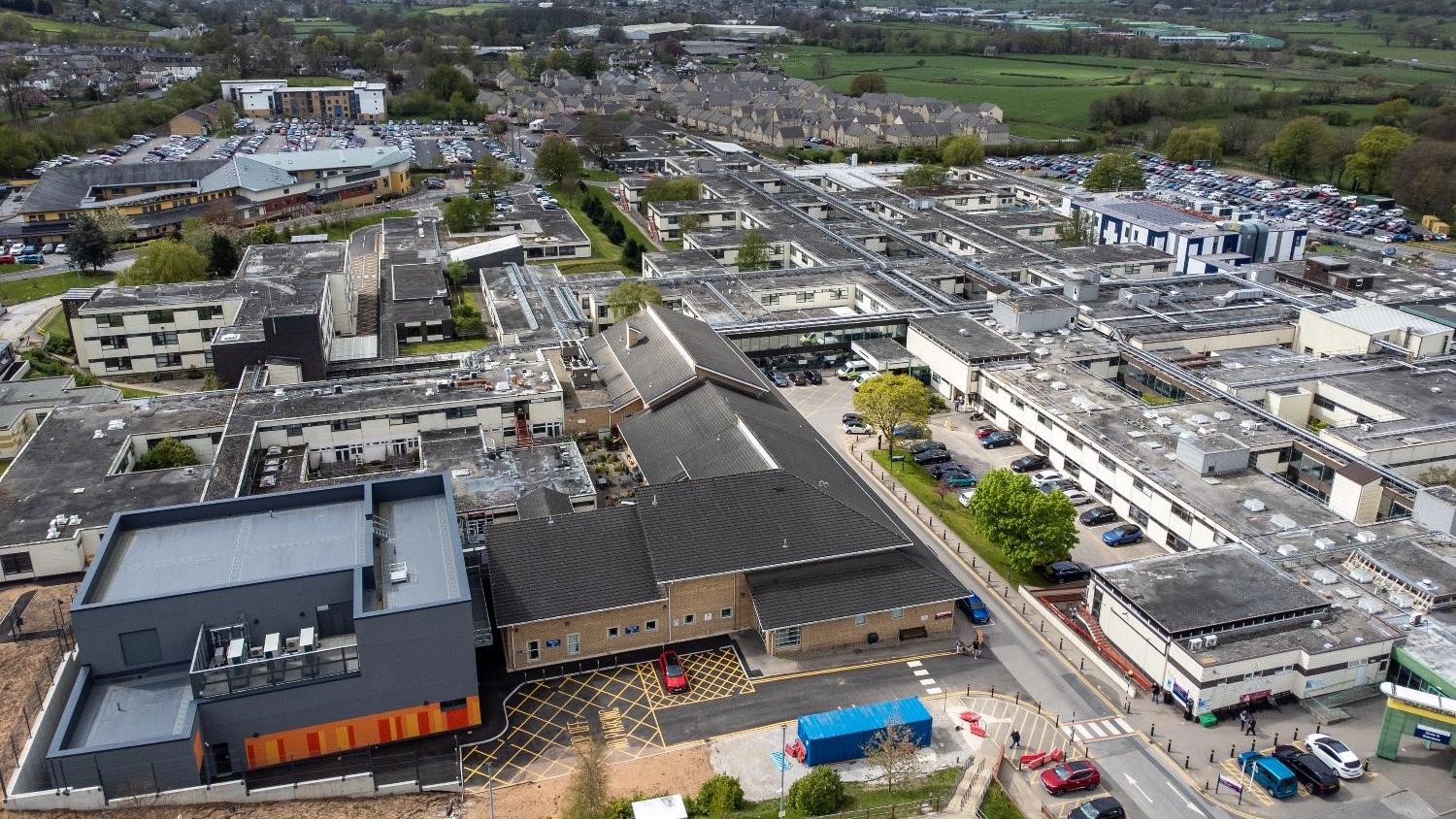
Among hospitals affected by the nationwide issue, Airedale has the largest extent of RAAC – 83% of the estate is constructed almost entirely of the material – and has more than 50,000 RAAC panels in its walls, floors and ceilings.
Nick Campbell-Voegt, director at BIS Consult, explained how the hospital has been dealing with the issue. “Accurate and reliable information is a critical resource to help the hospital manage the risk of RAAC,” he said. “Data collected during daily inspections helps to track changes in RAAC condition and monitor the overall risk profile of wards and floors. This informs the remediation plan and ensures that works are installed effectively and efficiently.
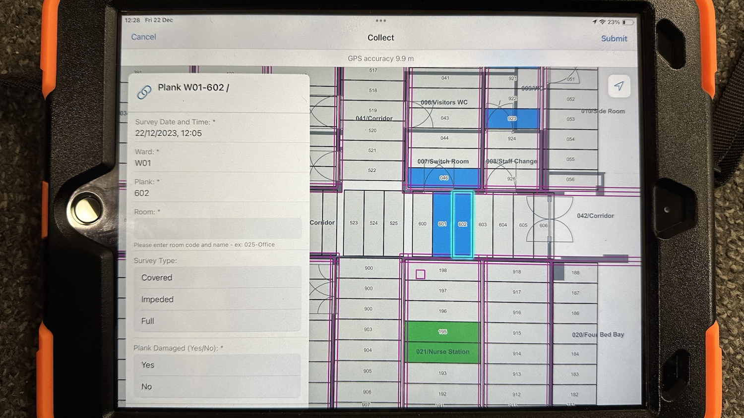
“Until recently, the inspection process has been paper-based, with field workers marking up floor plans and completing hand-written surveys. These were then scanned and transposed to Excel. Photos were taken in the field and uploaded manually back at the office, with drawings frequently updated to show changes to risk.”
Richard Burgin, estates project manager at Airedale, emphasised: “The existing manual survey process was not capable of dealing with the sheer volume of work. It became obvious the hospital needed a single, joined-up view of RAAC risk to generate the inspection frequencies and the ongoing programme of remediation works.”
Streamlining data collection
Since being appointed to implement a RAAC data management solution, BIS Consult has used Esri UK’s ArcGIS platform to incorporate CAD files and RAAC data to create a digital twin of the material throughout the hospital.
Inspection data is now collected on iPads using custom forms, which helps dictate the risk rating of each plank. Planks are surveyed either monthly, every three months, every six months, or yearly, depending on their rating, in line with current guidance.
Patterns of deterioration can be clearly seen and investigated on an estate map, overlaid with drone imagery, which helps all stakeholders understand the problem more easily. Factors that impact on RAAC, such as the location of utilities and services, the orientation of a building and prevailing weather, can all be better assessed using this method.
The digital workflow also provides Airedale with a solid audit trail, which helps with compliance and reporting, which is directly linked to the government funding it receives to manage RAAC.
Campbell-Voegt said: “We have established an end-to-end workflow that enables surveyors to capture information in a live operational environment, using a mobile device to streamline their data collection and reporting process. This has now been effectively deployed, providing a system of record that drastically reduces the time needed to manage, analyse and report on RAAC information, creating a 50% efficiency saving. Ultimately, the tool provides stakeholders with greater insight and assurance around RAAC by helping to manage risk.”
Accelerated work programme
Airedale’s inspections team has reduced the manual effort in collating, managing and reporting on data by three FTE (full-time employees) per month on average. The increased frequency of inspections enables an accelerated programme of work.
Burgin added: “Esri’s ArcGIS has given us a more robust and resilient process, with a reduced risk of human error that instantly shows different levels of risk so we know where to focus. RAAC has a major operational impact, sometimes disturbing clinical and operational functions so surveys and mitigation work needs to be accurate and fast and the system underpins that.”
Airedale is keen to continue to mature the RAAC digital twin and data analytics capabilities, with a desire to understand the root cause of changes to planks and events that could trigger plank deterioration, such as adverse weather.
Incorporating new data sources
BIS Consult will continue to develop and enhance the data model to incorporate new data sources, including from sensors that could trigger alerts.
Burgin noted: “Moving forward, the reporting function will act as a single source of truth with accurate and up-to-date reports being generated in a range of formats. This will enable clear and factual supporting data to be presented to both internal and external stakeholders.”
Paul Clarke, head of government at Esri UK, said: “The Airedale General Hospital project is the first of its kind in the UK and showcases best practice in the advancement of RAAC management. Defining the risk from RAAC is a significant challenge across the public sector, including hospitals, schools and other public buildings. Interest in the geospatial approach has been high, as mapping the indoors helps organisations to understand the risk in a cost-effective, accurate and efficient way and then to prioritise mitigation works. It helps keep buildings safe, open and delivering services to the public.
“Using dashboards to visualise the data makes it easy to share new insights with key stakeholders, from board directors to contractors. People have been using maps in the outdoor world for centuries, but indoor mapping is relatively new. Moving indoors with mapping opens up many new benefits to help manage assets, from RAAC to asbestos.”
Don’t miss out on BIM and digital construction news: sign up to receive the BIMplus newsletter.