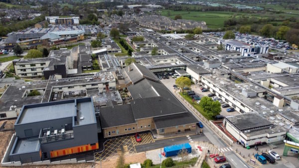
Utility company Severn Trent Water has pushed the boundaries of drone use with its in-house fleet of robotically-automated, thermal imaging and confined access machines used for a variety of survey and inspection tasks.
A dedicated team of drone pilots was specifically trained to operate the various UAVs, create reports, perform root cause analysis, and educate people in different departments on the opportunities. The combined efficiencies have enabled savings and cost displacements of at least £750,000 a year for the business.
Keith Leadbetter, O&M assurance manager at Severn Trent Water, told BIM+: “Drones have displaced the need to scaffold for certain inspections, site surveys are cheaper and we can simply convert the data into CAD rather than having to pay people to do that work. We’re improving methods of access to reduce health and safety risk, which also reduces the risk of asset failures on large structures like the dams and digesters. We can now do less work in confined spaces, which is traditionally expensive because it requires teams of humans to be trained and breathing apparatus etc.”
The water company recently took its first step into robotic drone missions, using the programmable Mavic Pro to survey sites with greater accuracy than using a human pilot.
The site or asset being surveyed is first highlighted on a satellite image in PIX4D software, which works out in the most efficient route to fly depending on the wind speed. The machine then flies the route autonomously capturing images with a pilot on hand to step in if there are any issues. Ground control points placed around the site provide a reference to satellites to improve accuracy when images captured by the drone are stitched together.
“The system has enabled us to survey all our dams within 20 millimetre accuracy and create seamless 2D images and 3D models,” says Leadbetter, “In the past we would have had to abseil down the dam faces and take thousands of photographs and then manually stitch them together, which just doesn’t work, it’s too big.”
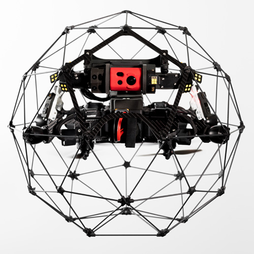
ELIOS 2 drone by Flyability is surrounded by a carbon fibre protective frame
Severn Trent Water is turning increasingly to drone-based thermal imaging to identify faults, leaks or other anomalies. The technology was used to scan anaerobic digestion tanks to highlight changes in temperature that might indicate a leak or a loss of efficiency and to monitor the flow of wastewater from a sewage treatment works through reed beds.
Hot spots in images of its solar panel installations can indicate areas of damaged cells or burnt out cables where joints have deteriorated. The utility has experimented with machine learning software, developed by Microsoft, that can ‘learn’ the visual appearance of different failures in solar installations, such as stone chips, faulty panels, or a hot spot on a cable, and automatically scan drone-captured footage to identify them.
Drone-mounted thermal cameras have even been deployed as a more efficient and economic form of security, used to detect potential intruders on sites.
Confined or restrictive spaces are often no-go areas for humans, but the ELIOS 2 drone by Flyability is surrounded by a carbon fibre protective frame designed to bounce off obstacles without interrupting the recording of high-resolution stills or video. GPS-free stabilisation enables the drone to navigate in indoor environments, it features HD live streaming, and what is billed as the most powerful lighting system ever fitted to a drone, which can emit 10,000 lumens of light.
Severn Trent Water used the machine to study culverts and to examine the substructure of wells due to be capped off to help contractors understand the substructure and the risks involved. However, ELIOS 2 is not EX rated and therefore cannot be flown in a potentially explosive atmosphere. “You can fly it in a gallery fitted with chlorine pipes, where space is restricted and you would normally have to enter wearing breathing apparatus,” says Leadbetter.
The ability to fly drones beyond visual line of sight (BVLOS) of pilots, pending the approval of relevant regulations, could open up even more use cases for the sector. The Civil Aviation Authority is working on trials with stakeholders across a range of industries to devise an appropriate and safe solution.
“Our sites are very big, so rather than doing multiple flights using something like a Wingtra drone, BVLOS could allow us to survey the entire site from one position in a much shorter period of time. Everyone is coming forward with new ideas of how we might use drones in new ways and where we might go next. The sky’s literally the limit,” concludes Leadbetter.
Image: Kanpisut Chaichalor/Dreamstime.com