


Dacorum Borough Council, Nottingham City Council and South Ayrshire Council have won support from geographic information systems (GIS) specialist Esri UK to take forward their digitalised planning projects.
Esri UK’s competition drew entries from 50 local authorities and revealed several common planning challenges faced by local authorities, including the improvement of community engagement, how to maximise the use of 3D visualisations and how to manage developer contributions more efficiently.
The three winning councils will receive free consultancy services from Esri UK and free access to its software. Esri UK will also also create a customer advisory board to disseminate GIS best practice within planning departments.
Nottingham City Council’s project will examine how geospatial technology can help increase the use of 3D visualisations within planning, both internally and with the public. Dacorum Borough Council’s pilot will be using GIS systems to better manage the use and communication of developer contributions secured through planning obligations, while South Ayrshire Council’s objective is to create an innovative community consultation platform, with interactive methods of engagement to improve community involvement in local development plans.
Stephen Croney, head of sector for land, property and planning at Esri UK, said: “As the government looks to reform the planning system with an increased use of digital technologies, we wanted to find innovative solutions to planning challenges and collaborate with authorities to bring them to life.
“By combining each council’s domain expertise with our team of geospatial experts, the pilot projects will explore new and efficient approaches to problems, all designed to help make the planning process easier for everyone.”
Croney added: “Geospatial technologies can help shape the future of the planning process by delivering significant cost and time savings. Spatial data provides the common language to join different data together and make it meaningful. Helping to understand the spatial nature of our environment, so that we can better determine its future, means that more sustainable communities are created and helps with the levelling up agenda too.”
The winning councils’ plans
Dacorum Borough Council wants to translate existing text and spreadsheets by using digital mapping to better manage and communicate infrastructure and developer contributions, secured through planning obligations.
“The objective is to use digital mapping to help with not only the decision-making around the planning of new infrastructure and make the whole process more transparent, but also to support community engagement,” said councillor Alan Anderson, portfolio holder, planning and infrastructure, at the council.
“Our current system outputs are text- and spreadsheet-based – we believe that providing this information in a spatial way will provide a powerful asset that can be used by council officers and others for planning, decision-making and monitoring and also by the public to enhance understanding and engagement in infrastructure funding and planning.”
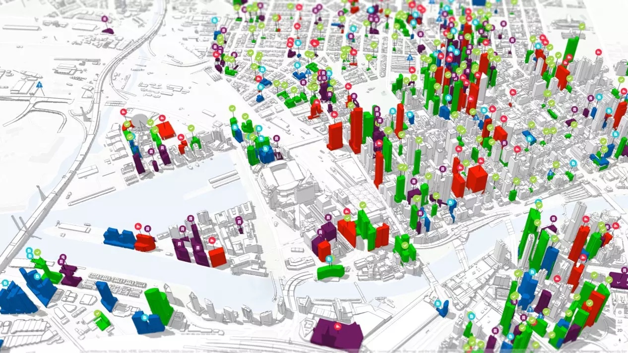
Nottingham City Council will explore how geospatial technology can help increase the use of 3D visualisations within the planning environment, internally and with the public.
“If 3D assessments are conducted in a GIS environment, planning teams will be able to conduct an assessment of various constraints on a site, at the same time as a visual assessment of the impact of the site.”
“If 3D assessments are conducted in a GIS environment, planning teams will be able to conduct an assessment of various constraints on a site, at the same time as a visual assessment of the impact of the site. This will enable better and quicker business decisions and greatly contribute to modernising the planning processes as per the government white paper,” explained Mick Dunn, GIS service manager at the council.
“GIS will bring other capabilities to the process too, from in-depth flooding analysis to view analysis, which we would like to be able to share easily with interested parties. We feel this could be pushed even further, perhaps being able to provide VR consultation on sites.”
South Ayrshire Council will examine how a community consultation platform with interactive methods of engagement can help further improve community involvement in local development plans – the proposed South Ayrshire LDP2 in the first instance.
“The objective is to create a space to keep our community engaged and informed to strengthen our relationship with our stakeholders, in order to reach better planning outcomes,” said Gordon Wilson, planning technician at the council.
“Effective public engagement can lead to better plans, better decisions and more satisfactory outcomes and it can help to avoid delays in the planning process too. Our vision is to build on the work already done by South Ayrshire in creating its LDP2, developing new apps and information to create a local plan community engagement and consultation hub, which will be more accessible, as the majority of people are now online.”
Don’t miss out on BIM and digital construction news: sign up to receive the BIMplus newsletter.


