


The Met Office’s Climate Data Portal is now live, giving organisations improved access to climate data and other resources, allowing them to better understand and respond to climate change.
Built using geospatial technology from Esri UK, the portal makes it easier for any business or government organisation to combine open climate data with their own data and thus reveal the future impact of extreme conditions (heatwaves, floods or droughts) on their operations.
The Met Office expects the main users to be within government, construction, land use, urban planning, transport, energy and healthcare industries.
The portal contains 60 different data layers, as well as guidance and information.
Combining Met Office expertise and data with Esri’s geospatial tools, the portal presents complex scientific climate projections in easy-to-use formats. The data is ready to visualise and analyse in GIS and non-spatial applications or it can be integrated into business processes for improved decision-making. Portal users can perform spatial analysis at a global, regional or local level. This enables location-specific action plans to be developed.
The project is part of the strategic partnership between the Met Office and Esri UK. The pair have been working together for more than 20 years.
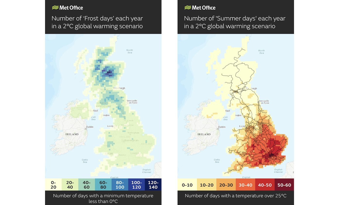
Climate risks over the next 100 years
“Historically, climate science has defined the problem. Now it’s moving to help with the solution, providing information at a local level which is highly relevant to UK organisations,” explained Professor Jason Lowe, head of climate services at the Met Office.
“Stakeholders can investigate their physical climate risks over the next 50 to 100 years. The most detailed climate projections reveal a greater chance of warmer, wetter winters and hotter, drier summers, and these help users plan and prepare for extreme weather, climate change and the reporting which new regulations, linked to climate change, will require.”
Esri UK managing director Pete Wilkinson added: “The Climate Data Portal is a giant step forward in making climate data more usable for UK stakeholders. Climate change presents a major challenge and this challenge is a geographic one. Using geospatial technology as a delivery mechanism for climate data makes it quickly accessible and usable in spatial and temporal analysis, helping to identify at-risk areas and develop location-specific action plans.”
Don’t miss out on BIM and digital construction news: sign up to receive the BIMplus newsletter.


