Needing to map a 32,500 sq m historic building quickly and still generate high-quality data, Boston-based Existing Conditions designed a hybrid workflow after testing the NavVis mobile mapping system.
Existing Conditions was founded in 1997 to capture high-quality as-built documentation as efficiently and accurately as possible.
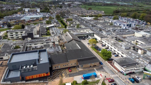
Last year, it landed a project to document the 14-floor, 32,500 sq m Independence Wharf at 470 Atlantic Avenue in Boston, Massachusetts. The 100-year-old building had recently changed hands, and the architectural firm tasked with updates needed as-built documentation for various improvements and upgrades.
Capturing the historic site presented several challenges. It is located in downtown Boston, fronting the Rose Kennedy Parkway, a major tourist attraction with a lot of pedestrian traffic. The pathway of a local harbour walk passes through the property. And finally, a large portion of the building sits on the pier itself, over the Fort Point Channel.
According to Existing Conditions’ vice-president of operations Brian Ely, these challenges are fairly typical. In the past, the company has documented many buildings of this complexity and size, dating to its early days using total stations, measuring tape and graph paper.
The team’s challenge, instead, was to use this site as a stress test for a new way of working that would deliver better documentation faster than before.
Breaking the status quo
In the past, Existing Conditions would have captured the site using some combination of terrestrial laser scanners (TLS). This would have offered the highest accuracy possible. The problem, says Ely, is that TLS are not nimble enough for the company’s workflows. “We’re not typical surveyors where we’re on a project for a long time,” he says. “Our timeline is much faster.”
That’s why the team historically sped up the process by performing their TLS scans in grayscale. Capturing in colour with industry-standard systems would have required treble the time and kept them in the building beyond the end of the timeline.
Ely says the other problem with TLS is that the scanning process can be so deliberate – and offer so little feedback – that the team cannot always be sure they’ve captured everything.
“There are times when we’re doing a building where we only have one shot. If we’re doing a Massachusetts Bay Transportation Authority tunnel, for instance, it takes almost an act of Congress to get us in there. So we need to be able to leave the site knowing that our data is good.”
Existing Conditions has kept an eye on mobile mapping as a possible solution. This technology enables the site to be captured quickly in colour, but with one significant caveat: many mobile scanners have a big problem with drift, where the relative accuracy of the data degrades as scan length increases.
“We couldn’t capture anything larger than a single-family house or a small retail space,” says Ely. “Anything larger than that and the drift just became too bad.”
Promise fulfilled
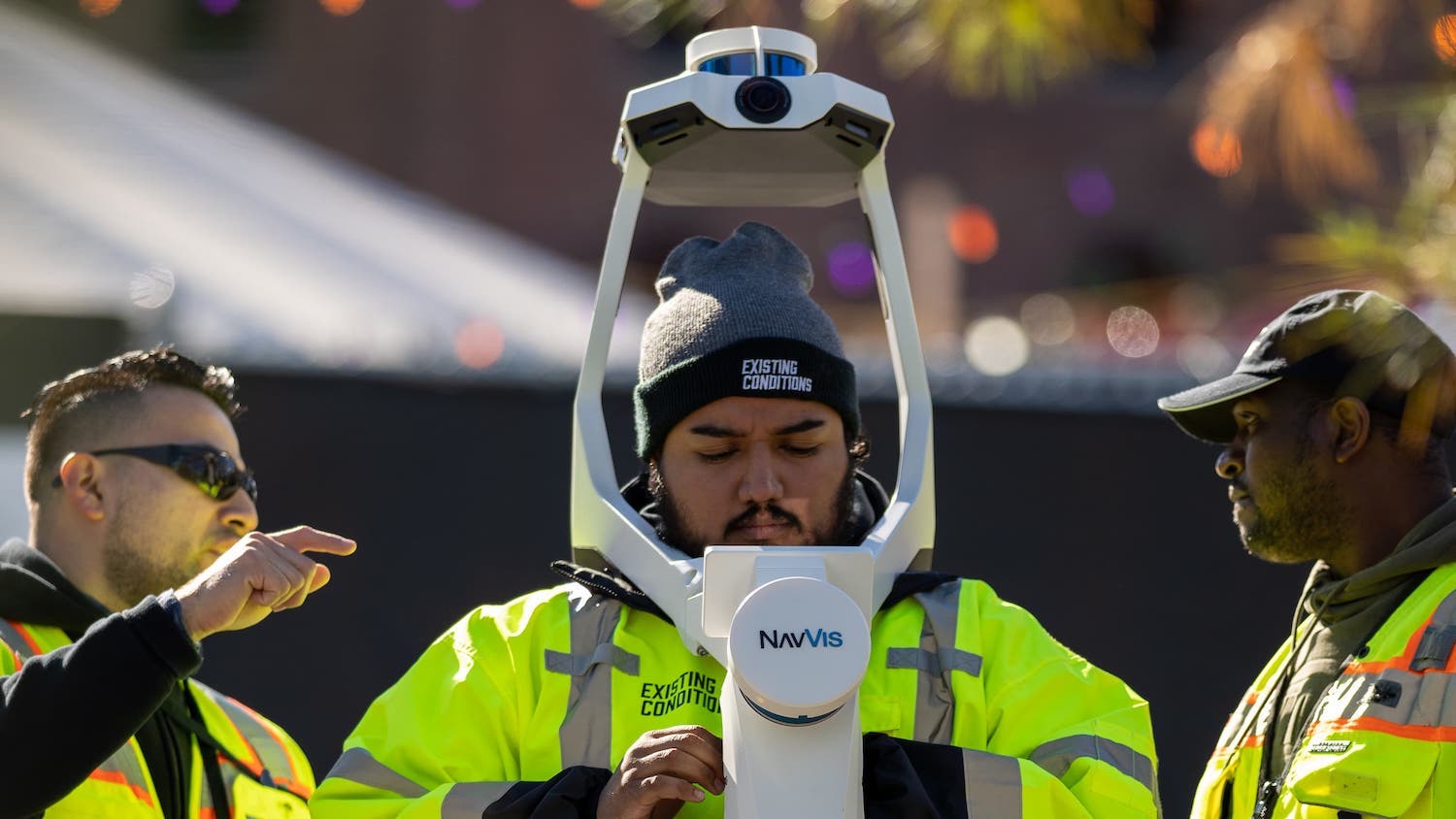
The team found its answer with NavVis VLX. Like many mobile mapping systems, the device would enable them to capture colourised data and do so much faster than they could with TLS. It would also offer the benefit of a screen that displayed live feedback on scan progress and quality, making it easier to get all the necessary data before leaving the site.
NavVis VLX also features a SLAM (simultaneous localisation and mapping) algorithm that minimises drift in complex indoor and outdoor environments. “This was the first time that we could actually use mobile mapping technology to get accurate information at that kind of speed,” says Ely.
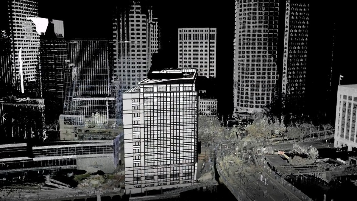
Existing Conditions tested the device before deploying it on the Independence Wharf project, scanning an area with terrestrial scanners, and then capturing the same site with NavVis VLX and overlaying the data for comparison.
The NavVis system returned accurate data in places where previous mobile mapping tools would have failed. That higher-quality data, coupled with the system’s colourisation, produced more aesthetically pleasing point clouds too. “From a legal standpoint, it doesn’t change our ability to create a nice model, but for marketing purposes and the client’s impressions? We knew they’d be much more appreciative of the data.”
To Independence
Following the successful test, Existing Conditions deployed NavVis VLX on the Independence Wharf project. To ensure the best possible data, it was used in a hybrid workflow.
The team captured the exterior of the 14-storey building using a Leica P50 long-range 3D TLS, even placing the device on a nearby bridge to ensure full capture of the water-facing side of the building. They also used a drone to get close to the building and capture detailed imagery of damage to the envelope. Next, they captured the parking garage and the building’s core using a Leica RTC360 3D laser scanner.
To set up control for the NavVis VLX data, the team placed targets at the core on each level. Then, they scanned a line out to the building’s corners using the RTC360. This gave them a frame to which they could attach the scans of each floor.
Finally, they walked the space with NavVis VLX, capturing each floor in its own scan.
The results
The NavVis VLX point cloud was accurate enough for the Existing Conditions team to identify several floor deviations throughout the structure and flag them for the new owner. “We’re able to see details that we might have missed otherwise, because we would have done the scanning in grayscale,” says Ely.
The company was also surprised by the speed of the device, which captured colourised data four times faster than it could have done with TLS. This helped it to reduce the budget by 25% overall.
Ely added: “This was the very first job we completed with NavVis VLX, so we were able to learn some things in the field about the best way to do things. But the machine made it so we were able to complete this building without the usual hiccups of onboarding new technology. It was really a nice, seamless process.”
Process and deliver
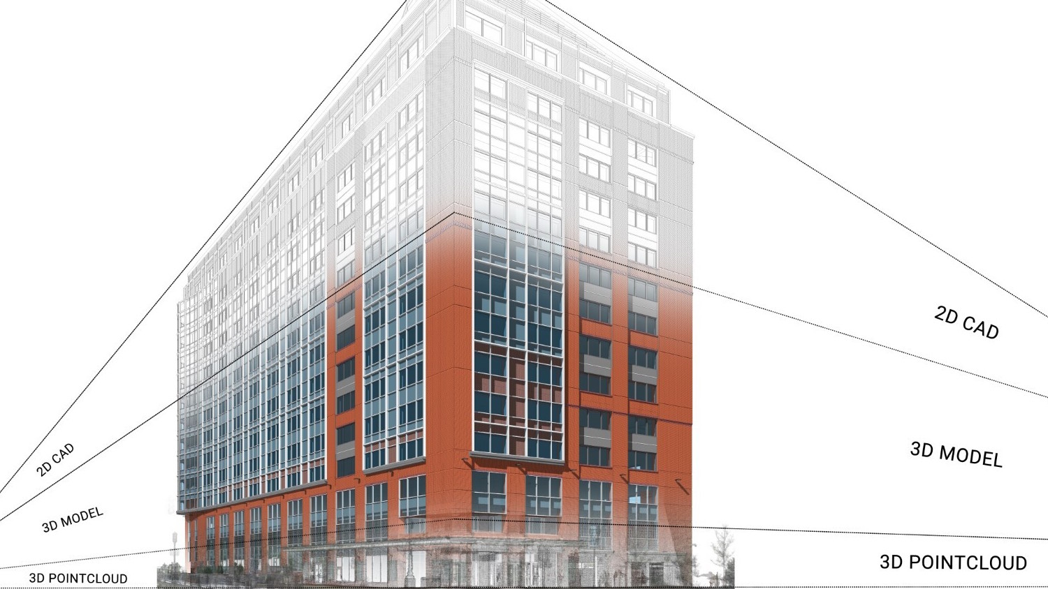
Ely details the process of stitching the various data sets together. “We processed the TLS data in Cyclone Register 360 and exported it as an .e57 file. Next, we brought them into NavVis Ivion, where we had processed the NavVis VLX data for each floor separately. Then we dummied up the building, and we were able to actually level each floor exactly right.”
Finally, all the data was fed into Revit, and it all just “snapped into place”.
Existing Conditions used NavVis Ivion as a platform for providing the client with virtual walkthroughs of the data. The architectural firm loved it, particularly the measurement tool, which enabled horizontal dimensions to be obtained quickly.
Mobilising for big projects
Having analysed the results from the Independence Wharf project, Existing Conditions has made a hybrid NavVis VLX and TLS workflow its standard for multi-day projects, at least in buildings larger than 50,000 sq ft. “That’s where we start to see savings,” says Ely.
He adds that NavVis VLX and NavVis IVION have proven very popular with Existing Conditions’ clients as well. “We’re starting to get clients asking us purely for mobile scanning. They don’t want us to go through with the RTC first.”
Don’t miss out on BIM and digital construction news: sign up to receive the BIMplus newsletter.