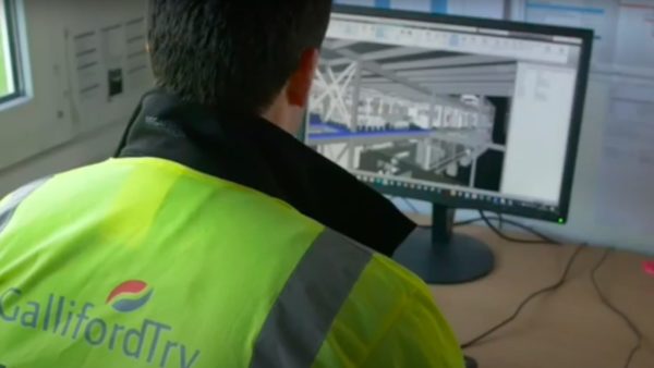
A full suite of technology, including drones integrated with BIM, has helped reduced risks and costs on the construction of a new logistics building in Dunstable, Bedfordshire.
Developer Baytree and Readie Construction have been using drones to produce survey grade accurate 2D/3D digital or reality capture outputs on one of their prime developments, a new 250,000 sq ft logistics building in Dunstable, close to the M1.
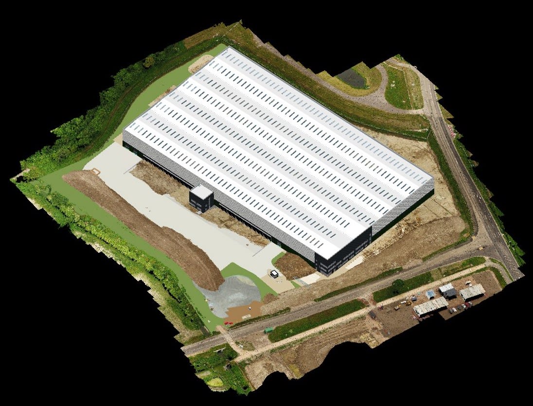
The digital/reality capture outputs (3D point cloud/textured model, digital surface model (DSM), 2D orthomosaic, (Google KMZ) created using drone technology and photogrammetry enabled both the developer and the contractor to improve the digital management of this large 15-acre asset, provided deeper data insights, better collaboration on the project, improved data deliverables to clients while reducing costs and risks. ProDroneWorx was engaged by Baytree and Readie Construction to do the survey work.
A digital twin of this project was regularly created to keep pace with changes on site and brought the following benefits:
- It helped surveyors, designers, project managers and senior management understand progress related to the design models.
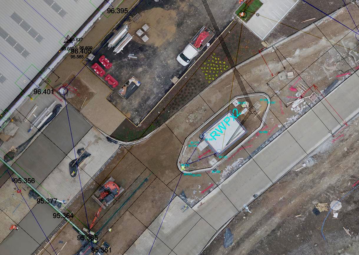
- It aided management of earthworks with cut-and-fill volumetric measurements.
- Enabled progress monitoring of the project at all stages of the build and against the design models and progress month to month.
- Facilitated quality assurance checks of the steel frame construction and integration of the high resolution imagery into BIM.
- Gave evidence regarding the amount of work carried out.
- Outputs were used within virtual reality (VR) and combined with BIM.
- 2D/3D reality capture outputs were integrated into existing workflow processes as the data was produced in various CAD, BIM and GIS formats, including dwg, dxf, xyz, las, laz, obj and e57.
Survey grade accurate 3D point clouds were created on this large 15-acre project of all areas, objects and structures using photogrammetry within two days of flying. The point cloud produced from a drone contained over 100 million points across the entire site with accuracies of less than 5cm and these were verified using check points.
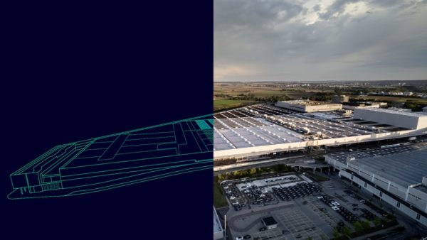
The models were imported into BIM or CAD
CAD models were overlaid on the orthomosaics in the project design phase
The models were imported into BIM or CAD software so that comparisons could be made against the design models and between time periods to track progress and ensuring the build was on schedule. The data was also used to closely manage earthworks onsite, cut and fill volumetric calculations were carried out from the point cloud data.
The single high resolution orthomosaics that were produced were orthorectified so measurements could be taken from them, they were also tied into the OS grid using ground control points for global accuracy.
CAD models were overlaid on the orthomosaics in the project design phase to understand and plan the orientation of buildings, road, footpaths, services, etc. It gave the user unique insights into the site and its surrounding area while also allowing the onsite and offsite teams to check project progress against design drawings.
A spokesperson for Readie Construction said: “The digital information produced by drone technology changed the way we managed this project, saving us both time and money. In just two days of the drone flight the 2D and 3D digital outputs were ready for analysis; which (due to the size of the project) would not always be possible using traditional methods. We were then able to use the data in our regular team meetings with contactors and to provide our client with progress on the project.”