Lyminge Parish Church Council has joined forces with the University of Reading and Topcon Positioning GB to find out more about the site of 7th century church remains.
Situated in Lyminge, a village rich with Anglo-Saxon history in Kent, is the church of St Mary and St Ethelburga. The building and surrounding churchyard have seen many changes over the years and boast their own intriguing history, but have also been hiding the remains of a 7th Century church for almost 90 years.
As part of the Pathways to the Past: Exploring the Legacy of Ethelburga project, Dr Gabor Thomas, associate professor in early medieval archaeology in the Department of Archaeology at University of Reading, and director of archaeology for the project, said: “The main objective of this project is to improve access to the church, especially for disabled people, by taking up the existing pathways and replacing them with more level alternatives better suited to wheelchair use. This work has provided the perfect opportunity for us to examine the archaeology of the church hidden underneath the existing paths.”
In the 1850s and 1860s, the remains of the current church’s Anglo-Saxon predecessor were unearthed and subsequently displayed until the decision was taken in 1929 to cover them over — and they have not been seen since.
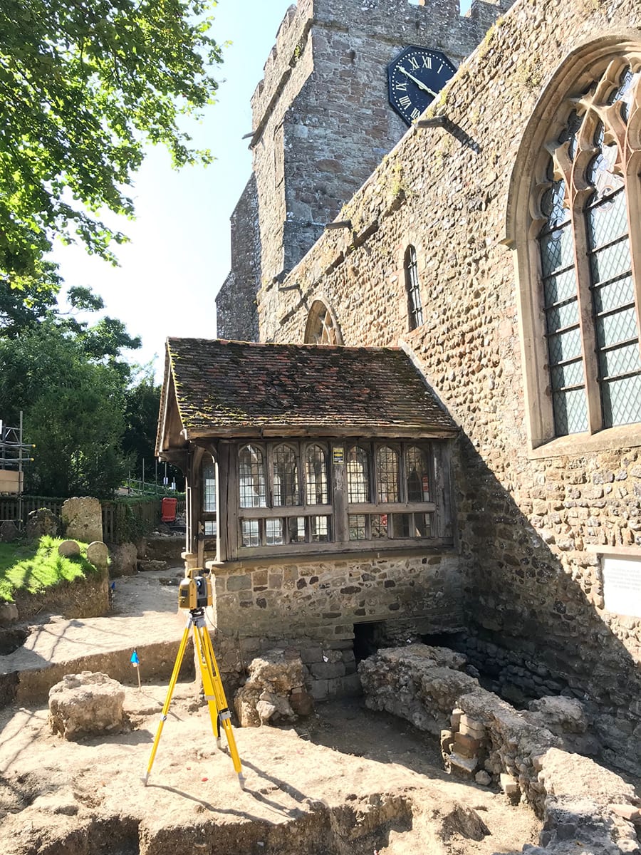
The GTL-1000 was also used to complete laser scans of the inside and outside of the current church of St Mary and St Ethelburga
Because archaeological practices were very basic at this time, the early remains were poorly recorded. This project gave Dr Thomas and his team a golden opportunity to re-expose the early church and to scan and record data in high levels of detail and precision, to preserve an intricate record of the site’s early history for future generations.
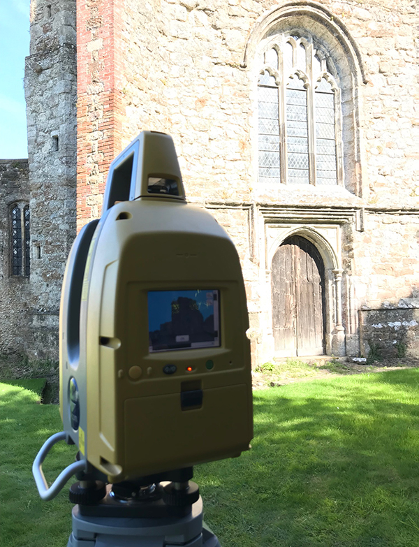
To do this, the University of Reading turned to former student and applications engineer for geomatics at Topcon Positioning GB, Aiji Castle, who recommended using the Topcon GTL-1000.
The GTL-1000 has all the features of a robotic total station combined with a fully functional laser scanner, giving the user the ability to use and establish a survey control network, as well as register point cloud data with one tool. With just three clicks and in less than two minutes, the new GTL-1000 can produce a complete, 360-degree, locally-registered point cloud of an area.
As well as being used to scan the remains of the 7th century church during the excavation phases of the project, the GTL-1000 was also used to complete laser scans of the inside and outside of the current church of St Mary and St Ethelburga. The church has a history dating back to Norman times but has been adapted and modified in the years since, with none of the changes recorded. The laser scans allowed the team to unpick the building’s constructional history in detail.
Castle said: “Now the area has been excavated and re-covered with new paths, the data collected will be interpreted and turned into 3D model structures that will go on display to the public. It’s been a really fascinating project to be a part of, and the team is very excited to see the digital versions on a screen display and pictures on the noticeboards for users of the church.”
Dr Gabor concluded: “This is one of the longest continually-occupied sites of Christianity in England with the extant remains from one of the very earliest stone churches of the Anglo-Saxon period. Now, thanks to Topcon and the surveying done as part of this project, it is also one of the most accurately recorded medieval churches in southern England.”
For more information about the Pathways to the Past: Exploring the Legacy of Ethelburga project, visit: www.geopaethas.com